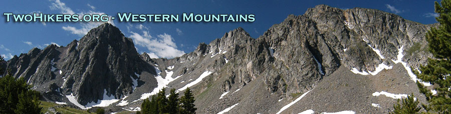
"Iffy" on the Continental Divide: Return to Colorado's Weminuche
Into the Gold
Wednesday, September 21
 Thankfully, it only sprinkled during the night a bit. We awoke to a 36 degree, partly sunny morning. We could already see some big clouds brewing, but for now, life was good. We had decided to definitely alter our route. Instead of staying on the West Ute Creek Trail, our new plan was to take a short cut to Twin Lakes, up the Middle Fork of Ute Creek. Yeah, we would miss West Ute Lake, but we would also "miss" the extra thousand feet of climbing over the ridge that divides the West and Middle Ute Creek drainages. Besides, the Middle Ute Creek looked so lovely, how could one pass it up?
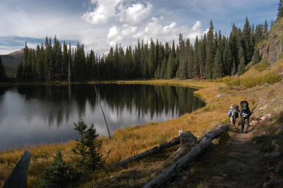
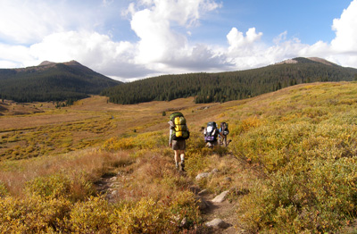
We pulled out of camp, and once we cleared the lake, we got some nice sweeping views up the Middle Ute Creek valley. This time of year is simply gorgeous, with all the yellow and golds.
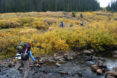
 We stopped for a short break after making some progress at about 3/4 of a mile up-valley from the point that the trail actually enters the Middle Ute Creek Valley. As we continued to proceed up the valley, I noticed that we were continuing to cling to west side of the valley at a point where the meadows are maybe 300 meters wide or so (near 283100 East, 4169700 North). This was not good, because we were supposed to be on the other (east) side of the valley. It was clear that we had somehow missed the fork in the trail that was supposed to have been maybe 600 meters back down the valley. Since we had been a bit spread out, it would seem that one of us should have seen the fork if it had been at all noticeable. Given the fact that there seemed to be no visible splitting of the trail, we decided to rely upon the brute force approach to regain our route, which meant thrashing through a considerable amount of willows. Fortunately, the willows were only dense near the immediate vicinity of the creek. I am not sure my bare legs would have been happy if there had been solid willows for the crossing.
 We arrived on the other side of the valley with only a limited expenditure of cuss words, and decided it was getting time for lunch. No trail was visible, and a GPS reading (283,350 Easting, 4169450 Northing) confirmed that we should have been standing right on the trail. After lunch, we prowled around, looking for evidence of a trail, and in the end, absent such, just decided that the terrain was sufficiently open and the route sufficiently obvious that we could just do the climbing, 350 feet or so, to Twin Lakes, sans trail. Susie and Tim led the way, and Susie seemed to have a knack for finding the route with the least amount of willows. As we got in sight of Twin Lakes, the first spot that we came to did not look at that great. Frankly, it was bumpy, boggy and exposed. Of course, in this area, once you get much above 11,400 feet, everything is exposed. I could see what appeared to be a large grassy spot immediately SW of the lakes, and so we headed over there. Unfortunately, the large grassy area had a pond right in the middle of it. Not ideal, but with the weather looking like it was deteriorating, the spot was looking more and more like home for the night.
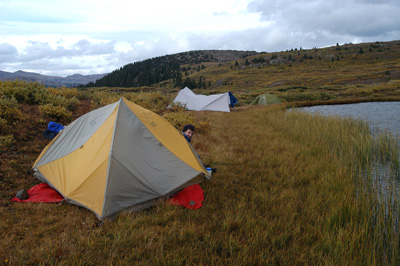 We set up our tents on the west side of this tiny strip of semi-dry ground, about the only stuff we could find that was sufficiently flat for tent erection. We jockeyed the tents around to take advantage of the driest areas, and then decided to get our tarp up. On mountain backpacks, a good tarp can make the difference between a rainy miserable night, and sharing a rainy miserable night with friends, chatting while semi-dry, between shivers. We were unusually close to the edge of the pond, probably within 10 or 15 feet. We figured that there were few rangers through here, and we have historically been low impact campers, so we decided that we should be ok. We also rationalized that if we camped near the water, then we could use other dry ground further away from any water as a potential bathroom, which, of course, would reduce impact. Anyway, camp was at 283401 E, 4168389North.
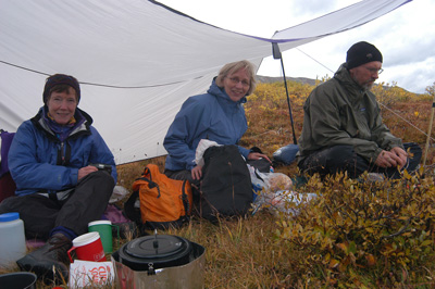 Just about the time we got the tarp up, it started to hail. I loved it. Not! Bathing in hail is not my idea of fun. We ducked under the tarp temporarily and then retreated to our respective tents. It seemed to shower on and off most of the remaining afternoon. I heated some water for Susie to take a bath in tentia, and she was gracious to let me use her rinse water to wet my head for shampooing it over in the grass. Reduce, reuse, recycle. The rest of my bath was taken between showers. Not fun, but it was good to feel clean. We started working on dinner about 5 pm, since it did not look like the weather would improve a whole lot. Chicken, orzo and peas was the fare for the evening. Anything hot and tasty was good under the tarp. We watched what our friend Carolyn calls "sucker holes," blue sky holes in the cloud deck, pass over, with frequent showers. It was good to be under the tarp. That said, we did not stay up too late chatting. Sleep, even though we had only covered six miles or so, seemed the thing to be doing.
Additional Photos of this trip can be found here: The Weminuche Wilderness 2005 on our SmugMug Photo Album Site
© Roger A. Jenkins, Suzanne A. McDonald, 2005, 2007, 2017